
Executive Summary
PlanIt&Go transforms how people plan outdoor activities by integrating weather data with location discovery. Unlike traditional weather apps that only show forecasts for specific locations, PlanIt&Go helps users find destinations that match their desired weather conditions within their preferred travel radius.
The Problem
Planning outdoor activities often means tediously checking multiple weather apps for different locations. Current weather applications have several limitations:
No personalization for weather preferences
Manual comparison required across multiple locations
No planning component to suggest alternative locations
Limited location suggestions beyond user-added places
Manual comparison required across multiple locations
No planning component to suggest alternative locations
Limited location suggestions beyond user-added places
The Solution
PlanIt&Go simplifies adventure planning by:
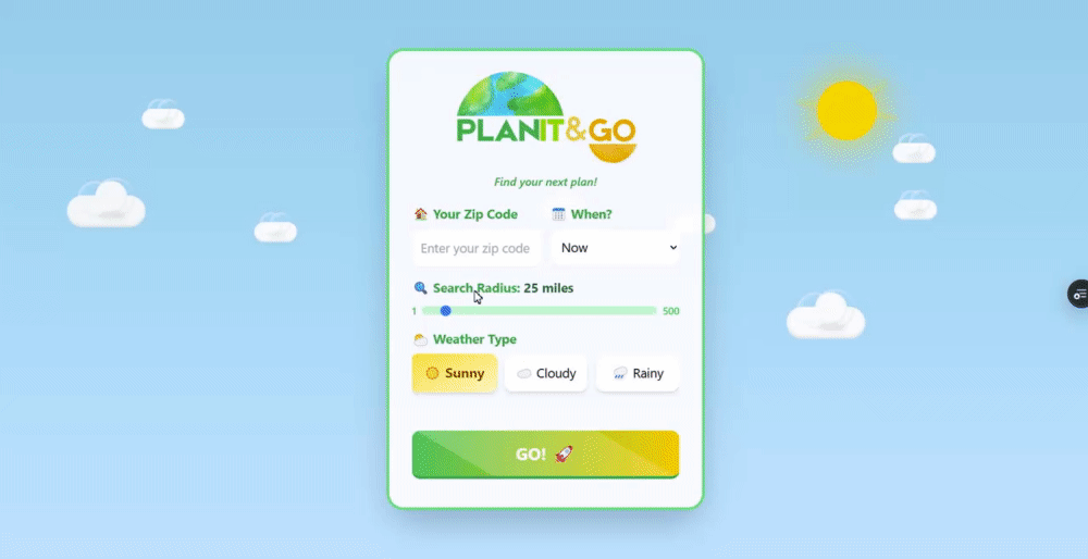
1. Personalizing weather preferences - Users select their desired weather type (sunny, cloudy, or rainy)
2. Automating location discovery - The app finds places with preferred weather within a specific radius
3. Prioritizing by proximity - Results are sorted by distance for easy decision-making
4. Providing future forecasts - Plan for today or up to 7 days ahead
2. Automating location discovery - The app finds places with preferred weather within a specific radius
3. Prioritizing by proximity - Results are sorted by distance for easy decision-making
4. Providing future forecasts - Plan for today or up to 7 days ahead
Future Enhancements
Activity Recommendations: Suggest specific activities based on weather conditions
User Profiles: Save favorite locations and weather preferences
Location Details: Add more information about each location
Weather Alerts: Notify users of changing conditions at saved locations
Transportation Integration: Provide estimated travel times and directions
User Profiles: Save favorite locations and weather preferences
Location Details: Add more information about each location
Weather Alerts: Notify users of changing conditions at saved locations
Transportation Integration: Provide estimated travel times and directions
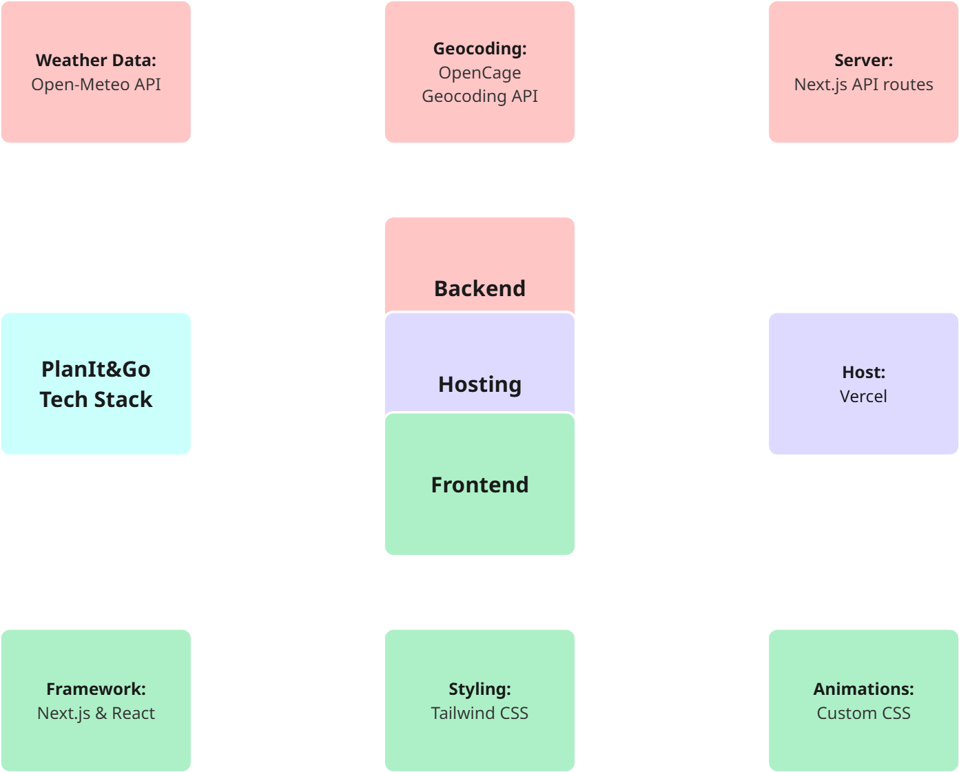
Logic
No-Code Tech Stack
Development Process
Logic Creation & Brainstorm
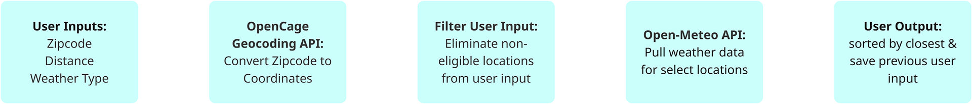
PlanIt&Go began as a personal issue. I'm an avid Bay Area hiker, and there are often multiple weather types within a one hour drive. I knew I wanted a tool that could source me weather data within select parameters, without adding locations manually. From here, I created the logic outline.
API & Calculation Research
First, I found the weather API. Open-Meteo API stood out to me because it's free under a high token-usage threshold. I realized it's input needed coordinates, so I had to find an API that converts the user input zip code into coordinates. Thus, I found OpenCage Geocoding API, which is also free under a token threshold. Since this tool isn't public, it works for me!
Prompting Anthropic Claude & Vercel V0
I went through about 3 main project variations.
The first project variation was strictly based on functionality, not user experience--using Claude. After it was created, I used Vercel V0 to come up with a basic UX framework inspired by the bubbly-art style made popular by Duolingo. Using V0 and Claude simultaneously created certain version issues, so I ended up having Claude rewrite V0's output in it's own style, and thus we got the second variation of the project with basic UX. For the final version, I focused on improving the UX directly through Claude creating custom CSS and general aesthetic choices that wouldn't affect the basic functionality of the tool. I also made quite a few manual edits through research and troubleshooting.
User Experience Features
Functional: Button highlight, distance sliding bar, saved user input, back button, expansive responsive layout, styled scroll bars, time dropdown for forecast selection
Aesthetic: Responsive animated weather backgrounds, time-responsive day-night background, pulsating submit button, animated loading screen